Equatorial Guinea, the volcano island and the forest
Africa’s only Spanish-speaking country: a 3,000-metre volcano above Malabo, beaches where four species of turtle nest, a forest of giant frogs and an island lost in the southern hemisphere.
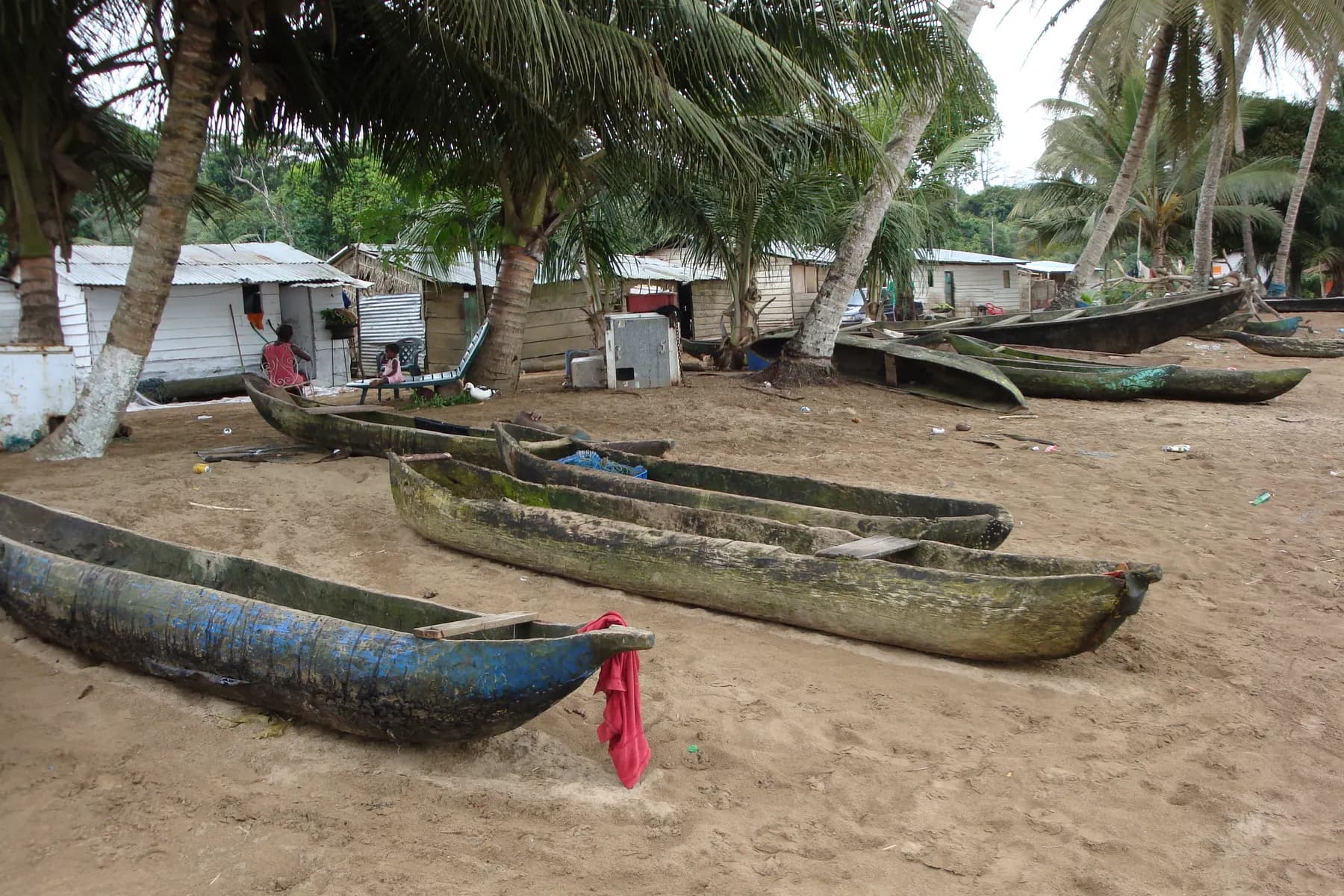
You expect Central Africa, and you hear ‘buenos días’. Equatorial Guinea is the only country on the continent whose official language is Spanish, a legacy of a colonisation that ended in 1968, and it shows everywhere in Malabo: the shop signs, the street names, the neo-Gothic cathedral of Santa Isabel, the wooden balconies of the colonial houses, the tortilla on the menu beside grilled fish. Then you look up, and Pico Basilé blocks the horizon: three thousand metres of volcano rising out of the sea.
The country comes in two pieces. The island of Bioko, to the north, facing Cameroon, carries Malabo, the volcano, the cloud forests and the turtle beaches; Río Muni, on the mainland, carries Bata, the largest city, the Fang villages and the Monte Alén forest; and far to the south, alone in the southern hemisphere, little Annobón. This notebook follows that order, from the volcano island to the forest, in a country where the traveller is still rare and where everything has to be earned a little.
Malabo, a bay inside a crater
Malabo was called Santa Isabel, and before that Clarence, in the days of the British who set up a base against the slave trade here in the 19th century. The city sits on an almost round bay that is in fact an old crater flooded by the sea: the dark cliffs that enclose it are its rim. The port, the cargo ships and the oil platforms offshore tell the country’s economy since the 1990s.
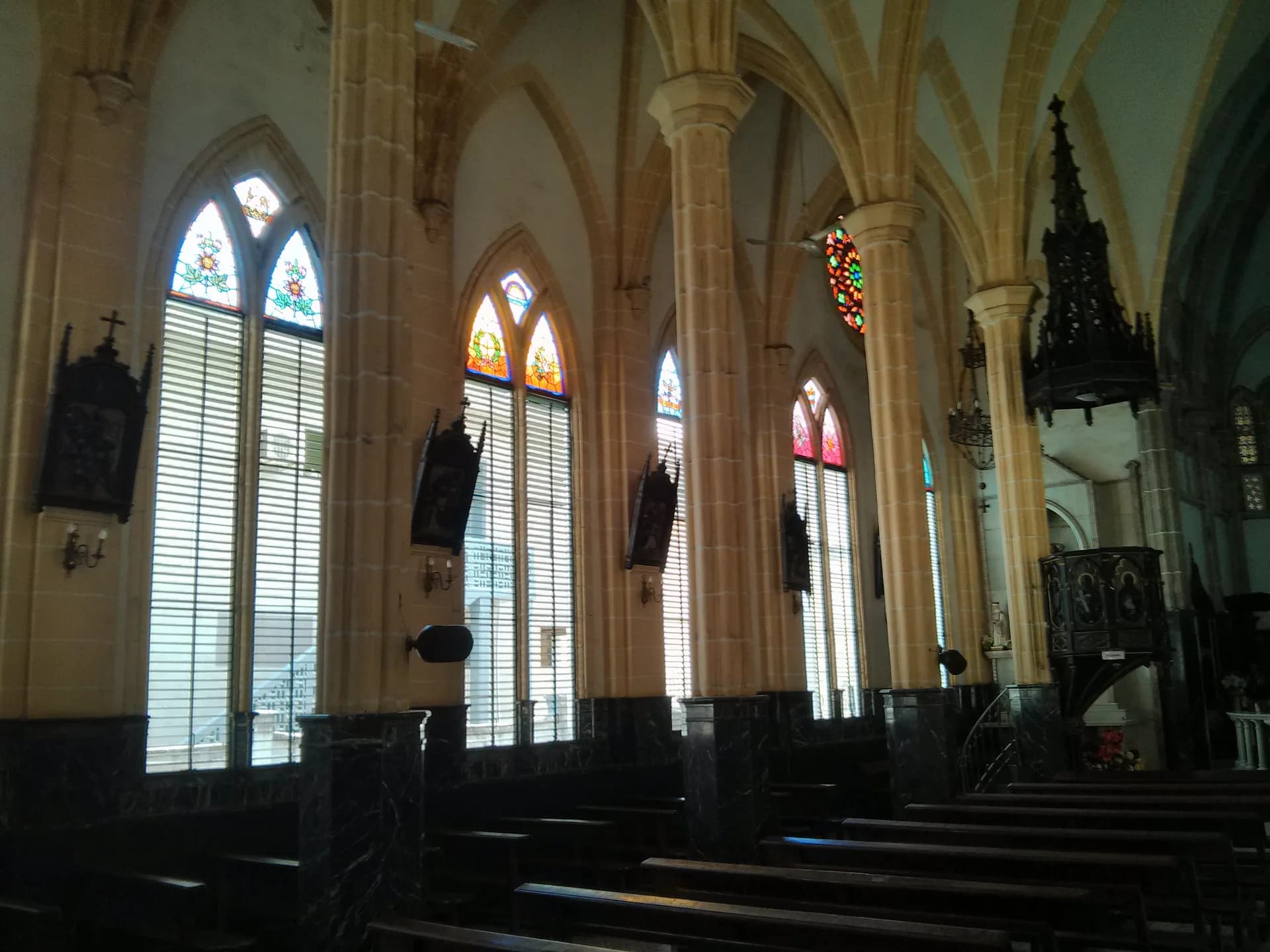
The centre keeps its colonial grid: the cathedral of Santa Isabel, built between 1897 and 1916, two pale spires on a shaded square; houses with wooden galleries, sometimes restored, often tired; the central market, and the Pichi language, an English creole that came from Sierra Leone and Nigeria and is spoken in the streets alongside Spanish and Bubi.
Since 2017 the country’s institutions have been moving little by little to Ciudad de la Paz, a brand-new capital drawn in the forest of the mainland, officially the capital since 2026. Malabo remains the historic city, the one you arrive in, and the base for everything that follows on the island.
Bioko, the volcano island
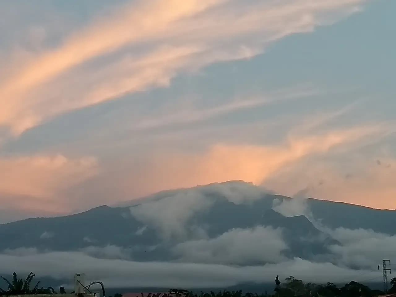
Bioko measures 2,017 square kilometres, which makes it the fourth largest island in Africa, only thirty-two kilometres from the Cameroonian coast. It belongs to the Cameroon volcanic line, the chain that runs from Mount Cameroon to the islands of São Tomé and Annobón, and is made of three overlapping shield volcanoes. The highest, Pico Basilé, reaches 3,011 metres; it last erupted in 1923 and its summit, in a national park created in 2000, is reached by road; on a clear day you can see Mount Cameroon from it.
The climb passes through a cloud forest home to seven species of primate, including the drill, a large monkey with a black face and a coloured rump, and Pennant’s red colobus, one of the most threatened in Africa. Protection programmes run with American universities have followed these populations since the 1990s and employ rangers in the villages.
South of the volcano, the Moka plateau, at over a thousand metres, is the country of the Bubi, the island’s original people, who had their kings here: the village bears the name of one of them. The air is cool, the meadows green, the Iladyi waterfalls drop into a forested gorge, and from here you set off on foot towards the south coast. Luba, the island’s second port, an hour’s drive from Malabo, keeps its beaches and its colonial hospital.
Ureka, the beach of turtles and rain
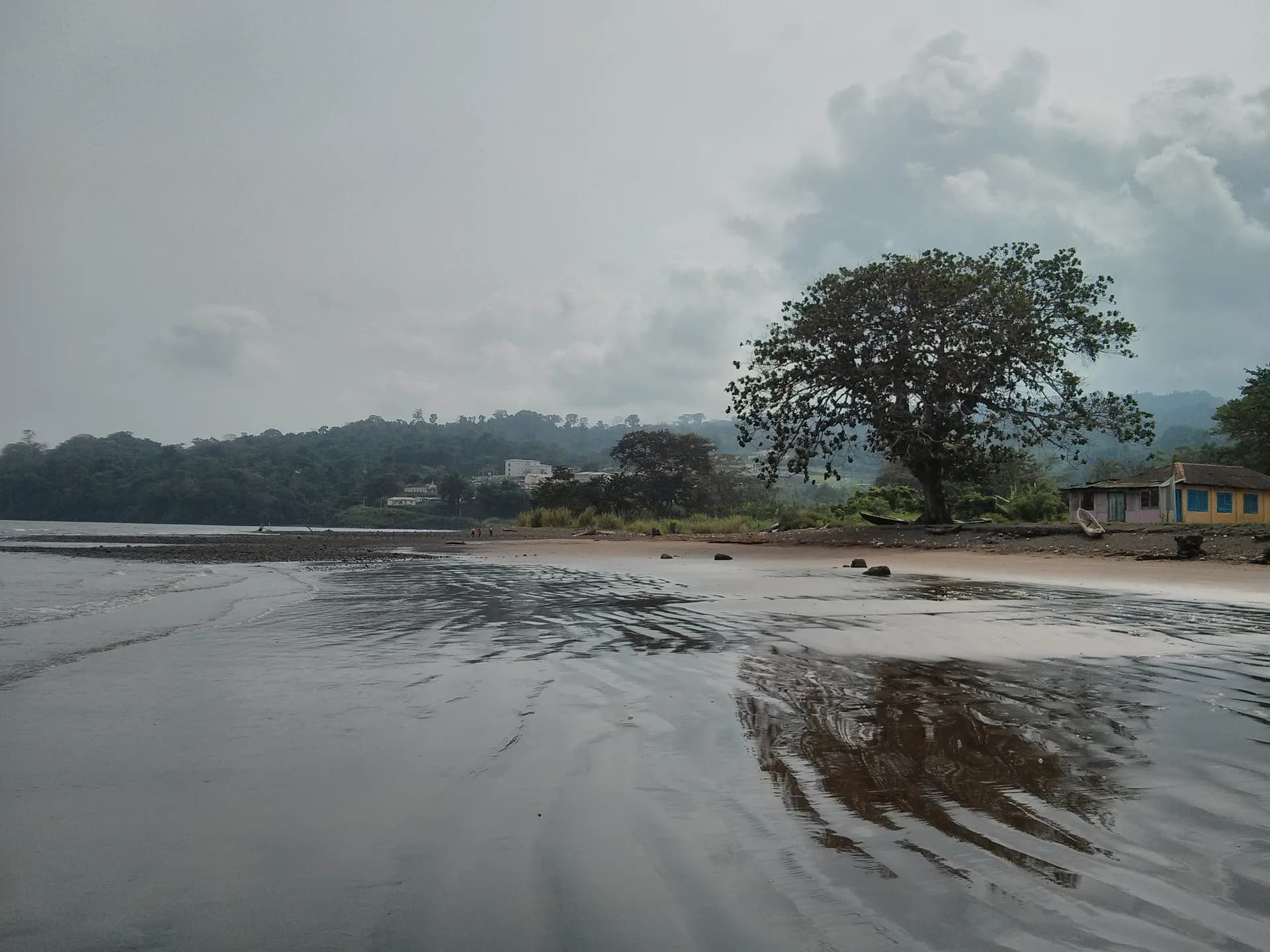
The south coast of Bioko is one of the wettest places in Africa: at Ureka, close to eleven metres of rain fall each year, against less than two in Malabo. The forest runs down to the black sand, rivers pour into the ocean as waterfalls, and the villages can be counted on one hand.
You go for the turtles. From November to February, four species come to nest on the beaches of Ureka and its neighbours: the leatherback, the largest in the world, the green turtle, the olive ridley and the hawksbill. Teams of local rangers patrol the beaches at night, count the nests and deter poaching; visitors go with them, in the dark, without a torch, and watch a leatherback of several hundred kilos haul itself up the beach.
You reach Ureka by the road that drops from Luba through the Luba Crater Scientific Reserve, or on foot from Moka in one long day. You need a guide, good shoes, a rain cape and a willingness to get wet.
Arena Blanca, Riaba: white sand, black sand
On a volcanic island, beaches are black. Arena Blanca, on the west coast half an hour from Luba, is the exception: a pale sand beach between two points of lava, edged with forest, which owes its reputation to its butterflies, in clouds during the dry season, and to its quiet: on an ordinary weekend you are almost alone.
Riaba, on the east coast, is the opposite: shining black sand, rollers, a small fishing town and a ruined Spanish fort. Between the two, the road circles the island through Bubi villages and cocoa plantations, many abandoned since independence, whose trees have gone back to forest.
Near Malabo, the Sipopo zone was built for international summits: a clean beach, hotels, a golf course, and few people outside the conferences. It is the easy beach; the others call for a car and a day.
Río Muni: Bata and the Monte Alén forest
The mainland begins at Bata, the country’s largest city, set on the Atlantic: a seafront promenade, a port, wide avenues, and the energy of a trading city where the Fang, the majority people, have their centre. From there, new roads run inland, towards Mongomo and towards the capital under construction.
In the centre of Río Muni, Monte Alén National Park, created in 1990, covers 2,000 square kilometres of equatorial forest: the largest protected area in the country, and one of the richest in Central Africa. You walk with trackers to the clearings where forest elephants, gorillas and chimpanzees pass, and search the streams for the goliath frog, the largest in the world, whose hunting is forbidden.
Off Bata, the island of Corisco and the two Elobeys keep white sand beaches and Benga villages; Corisco has been given an airstrip, and its lagoon remains one of the most beautiful in the Gulf of Guinea. The whole can be visited in a few days from Bata, with a driver and the necessary permits.
Annobón, the island at the end of the country
Six hundred kilometres south-west of Malabo, well beyond São Tomé, Annobón is the most isolated island in the country and the only one in the southern hemisphere: seventeen square kilometres of extinct volcano, a crater lake in the forest, and some five thousand inhabitants who speak Fa d’Ambô, a Portuguese creole inherited from the first settlers, far more than Spanish.
The capital, San Antonio de Palé, is a fishing village; fishing and the forest keep the island alive, and humpback whales pass offshore in season. People rarely go, by an irregular flight or boat, and stay as long as it takes for the next one to leave. It is one of the last islands of the African Atlantic where a traveller is an event.
At the table, and the rules of travel
The cooking mixes the Gulf of Guinea and Spain: pepesup, a fish broth with chilli and spices drunk scalding hot; grilled fish with plantains; cassava in all its forms; cassava leaves with peanuts. You drink topé, palm wine, and malamba, a fermented sugar-cane drink, and, in Malabo’s restaurants, a local beer with a tortilla.
Equatorial Guinea is a country you travel through with papers: a visa for most nationalities, permits for certain areas and for photography, a strict ban on photographing official buildings, the port and the airport, frequent checks on the roads. These rules change; our country guide keeps them up to date with the official advice, and it is better to read them before booking.
The dry season on Bioko runs from December to February, and it is also turtle season; on the mainland, the rains are less marked. You reach Malabo by flights from Madrid, Paris, Addis Ababa or Casablanca, then Bata by a one-hour domestic flight. The country receives only a few thousand visitors a year: those who come find an Africa without crowds, and people surprised, then glad, that you came.
Sources · 10
Live this journey.
Guided tours, excursions and tickets from our partner, in a new tab. Prices and availability are theirs.
The journal
Keep reading.
The luxury of an open horizon
A visual meditation on space, light and slowing down.
Lalibela, the town carved towards the sky
Eleven churches cut into living rock, a king who wanted his own Jerusalem, pilgrims in white at dawn: a notebook at 2,500 metres.
Meroë, the pyramids of the other Nile
Two hundred pyramids in the Sudanese sand, a kingdom that stood up to Rome, warrior queens and a treasure hunter: the Kush notebook.